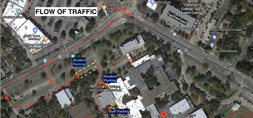
Crockett High School / ACC Autobody Center (South Austin)

Traffic Flow Map for Crockett High School and ACC South Austin An aerial Google Maps view of the intersection at Menchaca Road and West Stassney Lane in Austin, Texas, specifically highlighting the campus area of Crockett High School and the ACC South Austin Campus. The image features several red dashed arrows indicating a specific "FLOW OF TRAFFIC" for vehicles entering the campus from Menchaca Road. Key details include: Traffic Route: The arrows show vehicles turning off Menchaca Road into a side entrance, winding through a perimeter road past the tennis courts, and leading toward the school buildings. Designated Parking: Blue labels identify two separate areas for Student Parking and one area for Staff Parking near the Automotive Collision Repair and Refinishing building. Surrounding Landmarks: The map displays nearby locations such as Cherry Creek Catfish Co., Thrift Town, and the Austin Community College South Austin Campus across West Stassney Lane. Yellow Highlights: Dashed yellow boxes mark specific parking zones and drop-off points adjacent to the school structures.


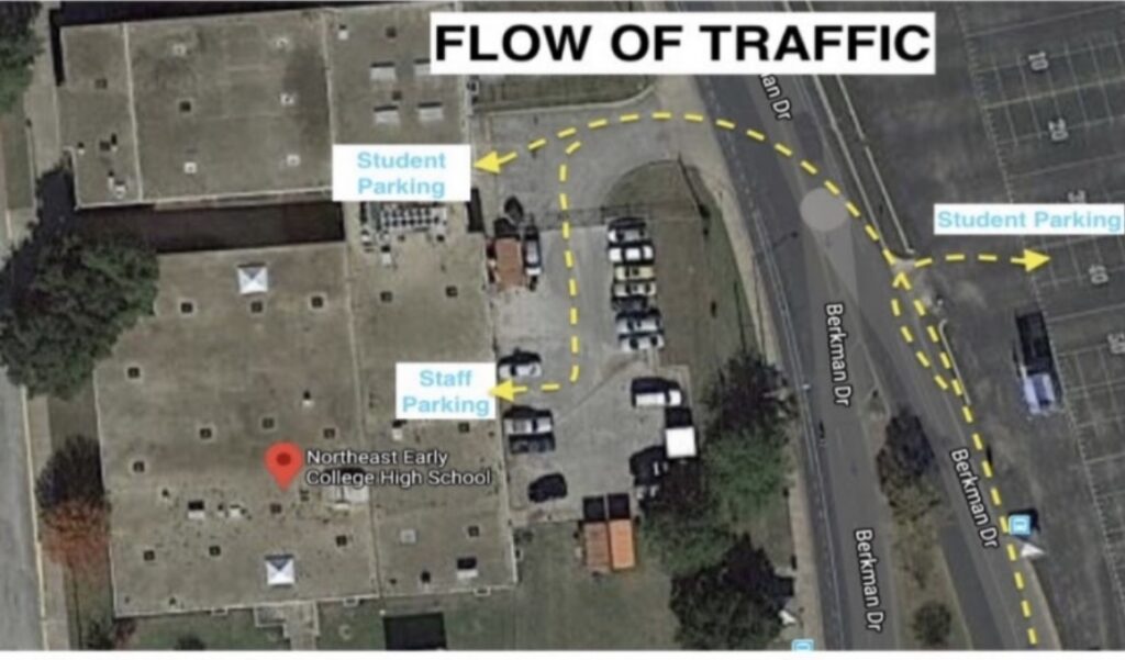
Northeast Early College High School / ACC Autobody Shop (North Austin)

Traffic Flow Map for Northeast Early College High School An aerial satellite view of Northeast Early College High School, located off Berkman Drive, detailing the specific "FLOW OF TRAFFIC" for students and staff. Key features of the map include: Traffic Directions: Yellow dashed arrows indicate vehicle movement. Traffic enters from Berkman Drive, with one path leading into a parking lot next to the school building and another path continuing north along Berkman Drive toward a larger parking area. Parking Designations: * Student Parking: Two areas are marked. One is a small lot immediately adjacent to the north side of the school building, and the other is a larger lot across from Berkman Drive on the right side of the image. Staff Parking: A specific area is labeled near the center-right of the main school building, accessible via the inner parking loop. Building Location: A red Google Maps pin identifies the Northeast Early College High School main building. Road Layout: Berkman Drive runs vertically along the right side of the school campus, serving as the primary access point for the highlighted traffic routes.