
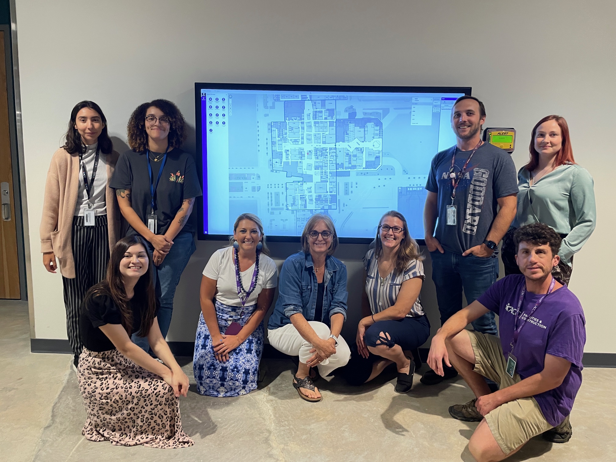
Meet the Facilities Information Systems (FIS) Team:
Desiree, Calyne, Renae, Deborah, Holly, Beth, Andrew, Molly, and Ryan (Jae, Weatherly, Andrea not pictured)
A Digital Solution for a Human Problem
We’ve all been there—wandering the labyrinth of campus buildings, desperately searching for that elusive classroom or office, feeling a little lost and a lot more frustrated. Luckily, that feeling is a thing of the past thanks to the hard work of the FIS team! Austin Community College (ACC) campuses are now equipped with a high-tech solution that’s going to make getting from point A to point B as smooth as a stroll in the park.
About the Digital Wayfinding Solution
The digital campus wayfinding application allows campus visitors to navigate through every campus floorplan in an easy-to-use interface. Visitors can search for specific classroom or office numbers, toggle through every floor of the building, and navigate to any campus in the ACC district. Visitors now have the opportunity to confirm their parking location and final room destination before setting foot on campus.
As a faculty member of ACC, I have a long history of meeting my students at landmarks around campus, such as the large Banana Split installation ( ACC Highland Campus pays homage to its shopping mall history by displaying food court nostalgia), instead of in my office. Why? Finding my office within almost 1 million square feet of interior space at Highland Campus was too much to ask of my students. Not anymore! Now, I can share my specific room location through a custom URL displaying a marker on the floor plan – a dream come true!
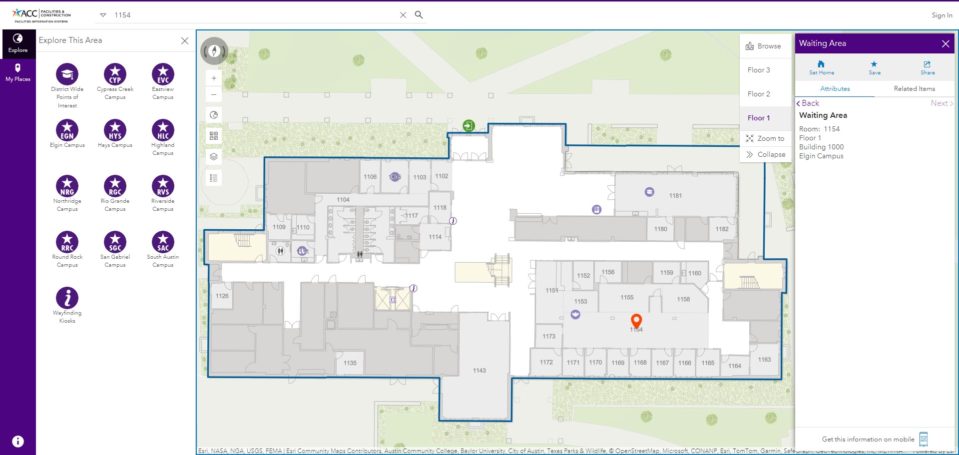
Meet the Solution: An interactive map of campus floorplans with custom tools allows visitors to find their way
About the Campus Wayfinding Project
The Team: One of the best parts of this project? Every single member of the FIS team is a proud ACC alum who once experienced that same sense of disorientation on our campuses. The FIS team is a dynamic crew with two former ACC GIS Department students, Beth and Holly, leading the charge. They’re backed by five GIS student interns and three CAD student interns, who’ve worked tirelessly on converting floor plans and verifying room locations. It’s worth noting that the CAD student interns have been instrumental in ensuring accuracy in every detail. They’ve channeled their own navigational struggles into creating a solution that’s both practical and innovative.
The Timeline: Since Fall 2021, the dedicated Facilities Information Systems (FIS) team has been exploring the world of digital wayfinding, starting with a free trial of ESRI ArcGIS Indoors. After testing the abilities of the technology against the needs of the district, it was clear this innovation could be a game-changer for every campus. By January 2024, the project officially kicked off, thanks to enthusiastic support and funding.
The Campuses: From the cozy confines of ACC’s smallest campus, Elgin, which spans 95,000 sq ft across three buildings, to the sprawling expanse of ACC’s Highland Campus, our largest campus at 982,000 sq ft across four buildings (a former shopping mall), Austin Community College has 11 campuses spreading from the northern San Gabriel Campus in Leander to the southern Hays Campus in Kyle.
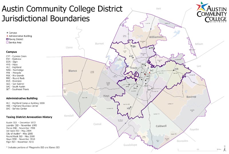
ACC Campuses within the Service Area
The Installations: The team worked diligently to tailor the wayfinding kiosks to meet the diverse needs of every campus. They have rolled out 46 kiosks and nine large touchscreen TVs across ACC campuses, with at least one kiosk at every location. This ensures that whether you’re at Elgin or Highland, help is always at hand.
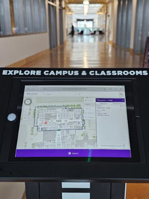
Meet the Digital Wayfinding Kiosk: ACC Highland Campus Building 1000 Classroom 2403 Navigation In Action
Campus Management: But why stop at just being practical? The ESRI ArcGIS Indoors platform has been pivotal in this transformation. As Esri highlights, “Our work environments have undergone significant changes recently. Indoor mapping and location intelligence have become crucial in managing these spaces effectively, making our digital wayfinding kiosks not just a nice-to-have, but a must-have in modern campus management.”¤
Student Passion Leads to an Innovative Solution
The team’s passion for this project is palpable. Having once navigated the same winding corridors and tricky layouts, they’re intimately connected to the challenges faced by our current faculty, staff, and students. The result is a user-friendly wayfinding system designed to make campus life easier and more enjoyable.
We’re thrilled to share this exciting development with our campus community and beyond. Our goal is simple: to help you find your way with ease, allowing you to focus on what truly matters—whether that’s engaging in academic pursuits, collaborating with colleagues, or simply enjoying the vibrant campus life.
So next time you’re on campus and feeling a bit turned around, remember: our wayfinding kiosks have got your back. Navigate your way with confidence and embrace the future of campus convenience.
Explore. Discover. Navigate. Welcome to the new wayfinding experience!
¤Esri (2021, January 28). Mapping the Future of Facilities and Workplaces with ArcGIS Indoors. ArcGIS Blog. Retrieved September 1, 2024, from https://www.esri.com/arcgis-blog/products/arcgis-indoors/3d-gis/mapping-the-future-of-facilities-and-workplaces-with-arcgis-indoors/